Garmin Tread - SxS Edition
ROAM THE UNKNOWN
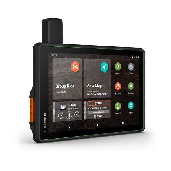
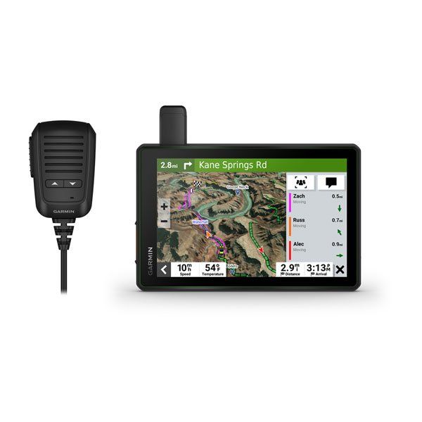
Hit the trails and have fun with your friends with this rugged powersport GPS navigator. It has all the mapping you need to stay on track and communication technology to stay in touch while you’re out there.
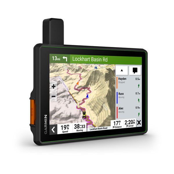
Keep your crew together with group tracking for up to 20 riders, plus push-to-talk fist mic.
Navigate unpaved roads and trails by using turn-by-turn trail navigation1 with OpenStreetMap (OSM) and USFS Motor Vehicle Use Maps.
This rugged navigator is IP67 weather-resistant and has a glove-friendly 8” touchscreen display.
See vivid aerial views of terrain with downloadable, subscription-free BirdsEye Satellite Imagery.
Use the Tread® app on your compatible smartphone for the Group Ride Mobile feature, easy route planning and more.
Peace of mind comes built-in. With an active subscription, you can use inReach® technology for global satellite communication.
RIDING RADIO FOR GROUP GETAWAYS
The included Group Ride Radio allows tracking for up to 20 Tread-equipped riders with no cellular coverage needed. Plus, the push-to-talk fist mic lets you easily stay in communication with your Group Ride friends. Pair Tread with your helmet or headset (not included) enabled with BLUETOOTH® technology for hands-free communication.
OFF-ROAD RUGGEDNESS
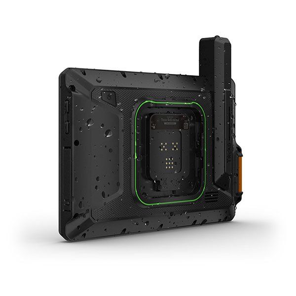
Purpose-built for all-terrain use, this Tread device stands up to anything the elements can throw at it. It’s IP67-rated for water-resistance and built to U.S. military standard 810G for thermal and shock resistance.
HIGH-VISIBILITY DISPLAY
With its ultrabright 8” glove-friendly touchscreen, the navigator is designed for easy viewing in bright sunlight or pitch dark. It can be mounted in portrait or landscape mode.
TRAIL NAVIGATION
Enjoy turn-by-turn trail navigation1 for traversing unpaved roads and trails using adventure roads and trails map content comprised of OSM and USFS Motor Vehicle Use Maps.
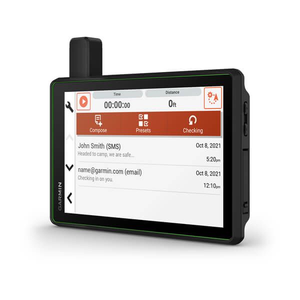
BUILT-IN INREACH TECHNOLOGY
Built-in inReach technology offers global satellite communication2, two-way text messaging, location sharing and interactive SOS.
MAPS ON AND OFF-ROAD
Tread features preloaded topographic maps with 3D terrain for North and Central America. It also includes detailed street maps of North America with Garmin Adventurous Routing™ options to take scenic and curvy routes.
KNOW YOUR BOUNDARIES
Access U.S. public land boundaries for national forests, Bureau of Land Management (BLM), wilderness areas and more. Also, see U.S. private land boundaries and landowner information for parcels greater than 4 acres.
SATELLITE IMAGERY
Enjoy vivid aerial views when you download high-resolution BirdsEye Satellite Imagery directly to your device via Wi-Fi® connectivity, with no annual subscription required.
ABC SENSORS
When you’re headed to tough-terrain, the built-in sensors will come in handy — including an altimeter, barometer, compass and pitch/roll gauges.
SECURE MOUNT
The included locking magnet-assisted mount and tube mount secure your Tread navigator to your powersport vehicle for riding over rough terrain.
GROUP RIDE MOBILE
Track friends from your compatible smartphone or Tread device when you and your friends use the Tread app’s Group Ride Mobile feature.
EASY ROUTE PLANNER
Use the Tread app to easily plan routes with the same maps, vehicle profiles and route preferences that you have on the Tread device.
EASILY SYNC YOUR DEVICES
Use the Tread app to sync waypoints, tracks, routes and collections across all your devices. Easily import and share GPX files, too.
LIVE WEATHER
Weather ahead? Pair your Tread device with your compatible smartphone, and download the Tread app to access live weather, storm alerts, animated radar and more.
Garmin Tread - SxS Edition is backordered and will ship as soon as it is back in stock.
Couldn't load pickup availability

Garmin Tread - SxS Edition
Payment & Security
Payment methods
Upgrade your ride today with the best off-road parts and enjoy flexible payment options with Affirm at checkout. Spread your payments over time and get the parts you need without the financial strain. Don't wait—enhance your UTV's performance now and pay later with ease!
Buy Now, Pay Later - Learn more | Affirm Disclosure
